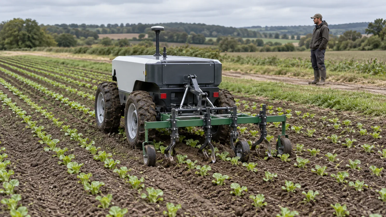
Agricultural field robots combine a mobile vehicle, a navigation system and a working implement to perform tasks such as seeding, mechanical weeding and field inspection. Their useful precision is measured where the tool meets the crop or soil. A vehicle can follow its intended route while a trailing implement, mistimed actuator or incorrectly aligned tool still misses the job.
Understanding these machines therefore requires following two connected control loops: one moves the vehicle through the field; the other positions and operates the implement. The engineering task is to keep both within the limits of the crop, terrain and equipment.
On This Page
- Follow the task from field map to working tool
- Choose the reference for navigation
- Control the implement as well as the vehicle
- Specify the connections and control authority
- Measure useful work and diagnose interruptions
- Match the architecture to the field operation
Follow the task from field map to working tool
A useful system boundary includes the field definition, route planner, position estimator, vehicle controller, implement controller and operator interface. The planner decides where to work. The estimator supplies position and orientation. The vehicle controller follows the route, while implement controls determine what happens at the working point. This is a functional breakdown; a particular machine may combine several roles in one controller.
Coverage planning has several distinct outputs. A swath is a working pass across the field; the headland is the end area used for turning and other transitions. Fields2Cover's route-planning documentation distinguishes ordering the swaths from computing the connecting headland path. Visiting rows in simple alternating order is only one option. Skipping rows or using another sequence changes the turns and travel between passes.
For integration, request a route that accounts for the complete vehicle-and-tool combination. A line that the chassis can follow is insufficient if the implement cannot make the turn or must stop working before the field boundary. Specify the requested tool state during work, disengagement, turning and resumption, and how the controller confirms that state before continuing. These are design questions, not claims that every platform implements the same state machine.
The operator's role belongs in this boundary too. Specify who releases a mission, clears an interruption and authorizes restarting the tool. The distinction between autonomous and automated systems helps frame those responsibilities more precisely than a single autonomy label.
Choose the reference for navigation
Satellite navigation supplies a global position reference. Real-time kinematic positioning, usually shortened to RTK, uses correction information to support precise positioning. Inertial navigation estimates motion and orientation from accelerometers and gyroscopes. VectorNav's GNSS/INS explanation describes how satellite measurements constrain inertial errors, and how inertial estimates can support navigation through interruptions in satellite reception.
That support has limits. Inertial errors accumulate without suitable corrections; installing an inertial sensor does not establish how long a machine can continue accurate tool work during a positioning outage. Ask what position uncertainty the controller reports and what tool behavior follows when that uncertainty grows. The broader sensor fusion guide explains why combining measurements also requires attention to timing and calibration.
Crop-relative navigation answers a different question: where is the machine relative to the rows it can observe? Cameras or lidar may supply that reference. It can be useful when the visible crop geometry matters more than a previously recorded line, but the crop's growth stage changes what the sensor sees.
A 2024 lidar crop-row study, version 1 illustrates that limitation. The authors identify sparse germinating plants, with little height difference from the ground, as a difficult case. Their quantitative simulated navigation results and qualitative real-field detection results should not be treated as a universal field accuracy rating. Row detection, successful driving and accurate cultivation are separate results to demonstrate.
A third approach uses the recorded planting operation. FarmDroid describes its FD20 weeding system as returning to saved seed positions rather than recognizing plants with cameras. That enables weeding before crop emergence. The dependency is equally significant: the weeding task needs the corresponding planting data. Seed coordinates identify where the crop was sown; they do not confirm that every seed emerged. A robot entering an unrelated field cannot acquire that seed-position history merely by following its rows.
Control the implement as well as the vehicle
Vehicle position and implement position need separate treatment whenever the working tool can move relative to the chassis. Passive implement guidance corrects tool position by changing the tractor's path. Active implement guidance gives the implement its own means of correction. PTx's tillage equipment reference illustrates these approaches with TrueGuide and TrueTracker, respectively. These are guidance examples, not evidence that either system turns an arbitrary tractor into an autonomous robot.
For a proposed combination, identify the point being measured and the point being controlled. Is the position reference on the vehicle, on the implement, or at a camera looking at the crop? Then ask how the controller accounts for their separation. Check the tool path through curves and transitions as well as on straight passes. A headline positioning figure without its measurement point cannot settle crop-clearance questions.
A tool carrier may also combine global navigation with local tool correction. Naio's retained ORIO page describes RTK guidance and a camera-guided side-shift system. Treat this as a historical architecture example: the page states that Naio SAS no longer manufactures, sells or supports ORIO as of June 15, 2026. Its description does not establish present support for an installation.
Timing matters as much as lateral alignment for an in-row weeder. An arm must enter the working gap and withdraw before reaching the protected crop area. FarmDroid's weeding-error guidance connects that motion to plant spacing, buffer size, arm travel and vehicle speed. Increasing forward speed leaves less time for the same movement.
The practical response to a timing problem is to examine the complete setup. Do not assume that a larger motor or a more accurate satellite receiver resolves it. Preserve the crop-protection requirement while investigating speed, travel, depth and mechanical obstruction.
Specify the connections and control authority
A compatible implement needs mechanical support, usable power and agreed control behavior. For a tool carrier, request the permitted mounting geometry and loads, clearance through steering and lifting, and the supplies required by the actual implement. A mounting category alone does not establish hydraulic capacity, electrical capacity or automatic control support.
The following questions are an engineering review checklist, not a universal connector specification.
| Interface | What to establish before integration | Why it changes the task |
|---|---|---|
| Mount and geometry | Tool location, working width, permitted loads and clearance throughout movement | The working path and turn envelope depend on the attached equipment |
| Power | Required supply, operating demand and behavior when power is interrupted | A tool must have a defined response when its energy source changes |
| Commands and feedback | Requested action, confirmed position or work state, and fault reporting | Sending a command does not confirm that the tool completed it |
| Field data | Coordinate reference, row or seed map identity, units and current task version | Navigation and application controls must refer to the same intended work |
| Control ownership | Who may command motion, who may inhibit the tool and who permits restart | Conflicting or stale requests need an explicit resolution |
For agricultural electronic interoperability, ISOBUS functionality is more informative than the presence of a connector. The AEF functionality guide explains that usable functions depend on support across the participating components. Universal Terminal supports implement operation through a terminal; TC-GEO handles location-dependent task data; TC-SC controls sections according to position and overlap. One supported function does not establish support for all the others.
Tractor Implement Management, or TIM, adds implement-to-tractor control. AEF's TIM documentation describes conformance testing and certificate authentication for that connection. This is a particular interoperability mechanism, not blanket approval for driverless operation. For a real procurement, check the exact component combination and supported functions in the AEF database, alongside the manufacturers' integration requirements.
The same discipline applies to proprietary interfaces. The open architecture explainer provides context for separating an accessible interface from verified interchangeability. Ask for behavior under lost messages and component replacement, as well as the normal command list.
Measure useful work and diagnose interruptions
Working width and speed provide only the starting point for output. Iowa State University's Farm Machinery Selection explains field capacity through width, speed and field efficiency, including time lost to turning, adjustment and servicing.
In metric units, effective field capacity in hectares per hour = working width in metres × working speed in kilometres per hour × field efficiency ÷ 10.
For a hypothetical 3 m implement travelling at 2 km/h with an assumed field efficiency of 0.65, capacity is 3 × 2 × 0.65 ÷ 10 = 0.39 ha/h. One pass over 10 ha would take about 25.6 field hours at that effective rate. These inputs illustrate the calculation; they are not measured robot performance. Account separately for off-field charging or transport if the chosen efficiency estimate excludes them.
An interruption log should distinguish navigation trouble from tool trouble. FarmDroid identifies hard soil, excessive knife depth and tangled material as possible causes of weeding errors, alongside timing settings. A route trace alone would not reveal all of those mechanisms.
Use the following proposed demonstration cases to make a supplier discussion concrete. None represents a test performed here.
| Condition to demonstrate | Result to inspect |
|---|---|
| Positioning corrections become unavailable | Reported uncertainty and the permitted vehicle and tool state |
| Crop rows become sparse or obscured | Whether the system detects an inadequate row reference before relying on it |
| Tool cannot complete its commanded motion | Fault identification and protection of the crop clearance |
| Machine reaches a headland | Tool disengagement, turn clearance and correct resumption of work |
| Operator requests a stop or loses the control link | Defined stopping behavior, visible status and restart authority |
Measure crop damage, missed work and recovery effort alongside path tracking. Set the acceptable results for the intended crop and operation before the demonstration. Successful navigation has value only if the agricultural task remains acceptable.
Match the architecture to the field operation
For pre-emergence in-row weeding, investigate how the planting map is created, retained and reused. For cultivation around visible rows, inspect crop detection at the growth stages that matter and measure the tool's clearance. For a carrier using interchangeable implements, prioritize the mounting, power and command interfaces before assuming one autonomy system can operate every attachment.
A field-inspection task may only need the vehicle to reach observation locations; a cutting or cultivating task needs much tighter coordination with the working tool. Ask the supplier to demonstrate the complete assignment, including row entry, turns, interruptions and restart, with the intended implement attached. Choose on the quality and continuity of that work, with the positioning specification as one input.
Sources
- VectorNav: GNSS/INS. Manufacturer technical reference on satellite and inertial navigation.
- Lidar crop-row detection research, arXiv 2403.17774v1. Research paper distinguishing simulated navigation measurements and real-field detection observations.
- Fields2Cover: Route planning. Project documentation on ordering working passes and headland connections.
- FarmDroid: Mechanical Weeding System. Manufacturer description of seed-position-based weeding.
- FarmDroid: Troubleshooting Weeding Error IN-OUT%. Manufacturer support guidance on tool timing and mechanical causes of errors.
- PTx: Tillage. Manufacturer examples of passive and active implement guidance.
- AEF: ISOBUS functionality guide. Industry foundation definitions and compatibility framework.
- AEF: Tractor Implement Management. Industry foundation explanation of TIM control and authentication.
- Naio: ORIO retained technical page. Historical tool-carrier example and current notice ending manufacture, sale and support by Naio SAS.
- Iowa State University Extension: Farm Machinery Selection. University guidance on working width, speed and field efficiency.
Last checked: September 10, 2026.